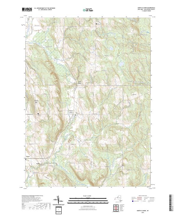
2023 Map of North Clymer
USGS Topo · Published 2023About this map
French Creek and its many tributaries, including Perkins Creek and Alder Bottom Creek, define the drainage patterns of this southwestern Chautauqua County landscape. The area is characterized by a series of small, rural settlements such as North Clymer, Clymer Center, and Jaquins, connected by a network of local roads like Panama Rock Rd and Bailey Hill Rd. These crossroads often feature small family or community burial grounds, including Wait's Corners Cem and Clymer Center Cem, which provide significant points of interest for genealogical research. The topography is varied, rising to heights at Sweet Hill and dipping into wetlands like Perkins Swamp and Tamarack Swamp. Traces of earlier infrastructure remain visible in the layout of the land, such as the corridor along Railroad St in North Clymer, reflecting the historical role of local transport in the region's development.
Find a feature on this map
59 named features on this map. Tap any name to fly to it.
Don’t see what you’re looking for? This feature index may not catch every label — zoom into the map to look around manually.
Map Details
Editions of this 2023 North Clymer Map
This is the sole edition of this map. No revisions or reprints were ever made.
Other maps of this area

1904 · Chautaqua
USGS Topo · 1:62,500

1905 · Clymer
USGS Topo · 1:62,500

1926 · Youngsville
USGS Topo · 1:62,500

1929 · Corry
USGS Topo · 1:48,000

1929 · Youngsville
USGS Topo · 1:62,500

1932 · Corry
USGS Topo · 1:62,500

1939 · Clymer
USGS Topo · 1:62,500

1941 · Chautauqua
USGS Topo · 1:62,500

1941 · Clymer
USGS Topo · 1:62,500

1943 · Youngsville
USGS Topo · 1:62,500