2023 Map of North Lewisburg
USGS Topo · Published 2023About this map
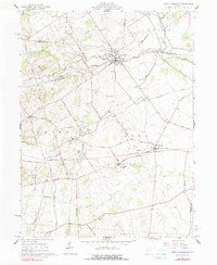
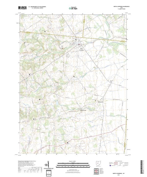
North Lewisburg and Woodstock anchor the landscape of this Central Ohio survey, where the rolling plains are drained by a complex network of waterways including Spain Creek, Big Darby Creek, and Treacle Creek. The geography reveals a long-established agricultural pattern at the boundary of Champaign, Logan, and Union counties, characterized by numerous small family and community burial grounds such as Sodom Cem, Butcher Cem, and Maple Grove Cem. The area around Fountain Park and Brush Lake suggests a local focus on water resources and recreation, while scattered landmarks like Jenkins Chapel and its associated Cem reflect the rural social fabric of the townships. The road system is defined by a grid of township highways and county roads, such as the Urbana Woodstock Pike, which connect these small settlements across the open terrain.
Find a feature on this map
80 named features on this map. Tap any name to fly to it.
Don’t see what you’re looking for? This feature index may not catch every label — zoom into the map to look around manually.
Map Details
Editions of this 2023 North Lewisburg Map
This is the sole edition of this map. No revisions or reprints were ever made.