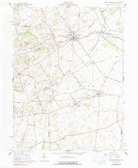
1961 Map of North Lewisburg
USGS Topo · Published 1990About this map
North Lewisburg and the nearby village of Woodstock anchor this portion of the Ohio landscape at the intersection of Champaign, Logan, and Union counties. The area is defined by its rail-driven settlement patterns, where the Erie-Lackawanna and Pennsylvania railroads cross the agricultural terrain. Local history and genealogy are well-represented by numerous burial grounds such as Sodom Cem, Maple Grove Cem, and Broderick Cem, alongside social centers like Jenkins Chapel and the Immaculate Conception Ch.
Find a feature on this map
42 named features on this map. Tap any name to fly to it.
Don’t see what you’re looking for? This feature index may not catch every label — zoom into the map to look around manually.
Map Details
Editions of this 1961 North Lewisburg Map
Other maps of this area

1913 · East Liberty
USGS Topo · 1:62,500

1913 · Richwood
USGS Topo · 1:62,500

1914 · Mechanicsburg
USGS Topo · 1:62,500

1915 · Richwood
USGS Topo · 1:62,500

1915 · East Liberty
USGS Topo · 1:62,500

1916 · Mechanicsburg
USGS Topo · 1:62,500

1916 · Milford Center
USGS Topo · 1:62,500

1944 · East Liberty
USGS Topo · 1:62,500

1944 · Mechanicsburg
USGS Topo · 1:62,500

1944 · Richwood
USGS Topo · 1:62,500