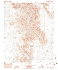
1983 Map of North of Tecopa Pass
USGS Topo · Published 1983About this map
Mound Spring and Resting Spring anchor a series of critical water sources scattered along the eastern edge of the Nopah Range. This 1980s-era provisional survey reveals a landscape defined by sharp elevation shifts and traditional desert travel routes, most notably where a trail or primitive road crosses through Emigrant Pass. The isolation of the Chicago Valley is punctuated only by the presence of a Borrow Pit and minor improvements to the road network on the valley floor.
Find a feature on this map
15 named features on this map. Tap any name to fly to it.
Don’t see what you’re looking for? This feature index may not catch every label — zoom into the map to look around manually.
Map Details
Editions of this 1983 North of Tecopa Pass Map
This is the sole edition of this map. No revisions or reprints were ever made.
Other maps of this area

1907 · Las Vegas
USGS Topo · 1:250,000

1908 · Furnace Creek
USGS Topo · 1:250,000

1908 · Las Vegas
USGS Topo · 1:250,000

1910 · Furnace Creek
USGS Topo · 1:250,000

1910 · Ivanpah
USGS Topo · 1:250,000

1912 · Ivanpah
USGS Topo · 1:250,000

1933 · Avawatz Mountains
USGS Topo · 1:250,000

1942 · Ivanpah
USGS Topo · 1:250,000

1947 · Trona
USGS Topo · 1:250,000

1947 · Kingman
USGS Topo · 1:250,000