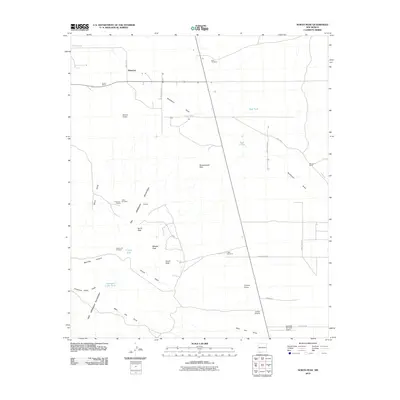
2010 Map of North Peak
USGS Topo · Published 2010About this map
Waterloo and the northern reaches of the Tres Hermanas Mountains anchor this landscape in Luna County, where the desert flats meet a series of prominent summits. The terrain is defined by a succession of peaks, including North Peak, Middle Peak, and South Peak, surrounded by a network of ephemeral drainage systems such as Burns Draw and Crump Draw. Resource extraction and ranching define the land use here, evidenced by the Lindy Ann Mine and Lindy Ann Claims located near the Wildcat hills. The presence of several remote outposts, including Inmon Ranch and the Lonesome Cabin, illustrates the survival of traditional cattle-rearing and prospecting livelihoods. Transport and logistics are represented by the Hacienda Sur Luna Airport in the south, while numerous windmills and tanks like East Windmill and Crump Tank highlight the critical infrastructure required for water management in this arid environment.
Find a feature on this map
36 named features on this map. Tap any name to fly to it.
Don’t see what you’re looking for? This feature index may not catch every label — zoom into the map to look around manually.
Map Details
Editions of this 2010 North Peak Map
This is the sole edition of this map. No revisions or reprints were ever made.
Other maps of this area

1899 · Deming
USGS Topo · 1:125,000

1915 · Deming
USGS Topo · 1:125,000

1917 · Hermanas
USGS Topo · 1:62,500

1917 · Columbus
USGS Topo · 1:62,500

1918 · Columbus
USGS Topo · 1:62,500

1918 · Hermanas
USGS Topo · 1:62,500

1920 · Columbus
USGS Topo · 1:62,500

1943 · Hermanas
USGS Topo · 1:62,500

1953 · El Paso
USGS Topo · 1:250,000

1955 · Las Cruces
USGS Topo · 1:250,000