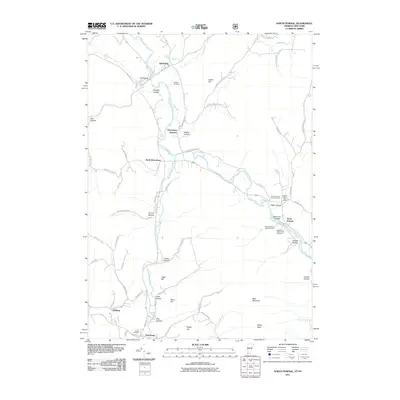
2011 Map of North Pownal
USGS Topo · Published 2011About this map
The Hoosic River and its tributary, the Little Hoosic River, carve a significant valley through this borderland where Vermont and New York meet. In the early 21st century, the landscape remains defined by its agricultural roots and the narrow hollows that extend into the surrounding uplands, such as Shingle Hollow and Halifax Hollow. The settlement pattern follows the water, with the village of North Pownal situated at a bend in the river, served by the North Pownal Post Office. For those researching local families, the map identifies several small burial grounds, including the Edgar Rathburn Farm Cemetery and the Woodland-J Wilcox Farm Cemetery. The intersection of rail and road at Petersburg Junction and the presence of names like Indian Massacre Rd hint at the layered historical activity within this river corridor.
Find a feature on this map
66 named features on this map. Tap any name to fly to it.
Don’t see what you’re looking for? This feature index may not catch every label — zoom into the map to look around manually.
Map Details
Editions of this 2011 North Pownal Map
This is the sole edition of this map. No revisions or reprints were ever made.
Other maps of this area

1886 · Greylock
USGS Topo · 1:62,500

1888 · Berlin
USGS Topo · 1:62,500

1890 · Berlin
USGS Topo · 1:62,500

1891 · Greylock
USGS Topo · 1:62,500

1893 · Greylock
USGS Topo · 1:62,500

1894 · Berlin
USGS Topo · 1:62,500

1897 · Hoosick
USGS Topo · 1:62,500

1898 · Berlin
USGS Topo · 1:62,500

1898 · Bennington
USGS Topo · 1:62,500

1898 · Greylock
USGS Topo · 1:62,500