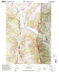
1995 Map of North Pownal
USGS Topo · Published 2000About this map
The Hoosic River winds through a landscape defined by the convergence of the Taconic Mountains and the southwestern edge of the Green Mountain National Forest. This mid-1990s survey illustrates the rural character of the tri-state border region where New York and Vermont meet. The river valley serves as a corridor for historical settlements such as North Pownal and North Petersburg, which grew around the valley's natural transport routes.
Find a feature on this map
38 named features on this map. Tap any name to fly to it.
Don’t see what you’re looking for? This feature index may not catch every label — zoom into the map to look around manually.
Map Details
Editions of this 1995 North Pownal Map
This is the sole edition of this map. No revisions or reprints were ever made.
Other maps of this area

1886 · Greylock
USGS Topo · 1:62,500

1888 · Berlin
USGS Topo · 1:62,500

1890 · Berlin
USGS Topo · 1:62,500

1891 · Greylock
USGS Topo · 1:62,500

1893 · Greylock
USGS Topo · 1:62,500

1894 · Berlin
USGS Topo · 1:62,500

1897 · Hoosick
USGS Topo · 1:62,500

1898 · Berlin
USGS Topo · 1:62,500

1898 · Bennington
USGS Topo · 1:62,500

1898 · Greylock
USGS Topo · 1:62,500