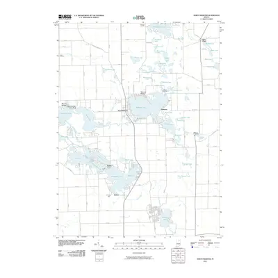
2010 Map of North Webster
USGS Topo · Published 2010About this map
Webster Lake and the town of North Webster sit at the heart of this post-millennium survey of Indiana's lake country. The landscape is defined by an intricate network of glacial kettle lakes and interconnecting waterways, such as the Tippecanoe River and Kuhn Ditch. The distribution of residential developments around Big Barbee Lake and Sechrist Lake reflects the region's long-standing transition from rural agriculture to a recreation-based economy. For those researching local roots, the map marks significant family-named landmarks including McClintic Cemetery and Cable Cemetery, alongside smaller communities like Indian Village and Wilmot. Engineering features such as the Weimer Black Dam and the complex shoreline of The Backwaters highlight how human intervention has managed these water bodies for residential and recreational use.
Find a feature on this map
84 named features on this map. Tap any name to fly to it.
Don’t see what you’re looking for? This feature index may not catch every label — zoom into the map to look around manually.
Map Details
Editions of this 2010 North Webster Map
This is the sole edition of this map. No revisions or reprints were ever made.
Other maps of this area

1950 · Leesburg
USGS Topo · 1:24,000

1950 · Pierceton
USGS Topo · 1:24,000

1950 · North Webster
USGS Topo · 1:24,000

1951 · Milford
USGS Topo · 1:24,000

1951 · Wawasee
USGS Topo · 1:24,000

1951 · Ormas
USGS Topo · 1:24,000

1953 · Fort Wayne
USGS Topo · 1:250,000

1956 · Fort Wayne
USGS Topo · 1:250,000

1956 · Ligonier
USGS Topo · 1:24,000

1956 · Lorane
USGS Topo · 1:24,000