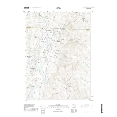
2018 Map of Northfield
USGS Topo · Published 2018About this map
The Connecticut River serves as the primary artery through this tri-state border region, where Massachusetts, New Hampshire, and Vermont converge. The landscape is defined by its alluvial plains and surrounding highlands, notably the Moose Plain and Beers Plain on the river’s eastern bank. Several small settlements and station points mark the historical transit corridor, including South Vernon, East Northfield Station, and Gill Station. The presence of Munns Ferry and the Schell Bridge highlights the long-standing importance of river crossings for connecting these agricultural and institutional communities.
Find a feature on this map
157 named features on this map. Tap any name to fly to it.
Don’t see what you’re looking for? This feature index may not catch every label — zoom into the map to look around manually.
Map Details
Editions of this 2018 Northfield Map
This is the sole edition of this map. No revisions or reprints were ever made.
Other maps of this area

1887 · Warwick
USGS Topo · 1:62,500

1889 · Warwick
USGS Topo · 1:62,500

1890 · Greenfield
USGS Topo · 1:62,500

1891 · Brattleboro
USGS Topo · 1:62,500

1893 · Brattleboro
USGS Topo · 1:62,500

1894 · Greenfield
USGS Topo · 1:62,500

1894 · Warwick
USGS Topo · 1:62,500

1898 · Keene
USGS Topo · 1:62,500

1932 · Brattleboro
USGS Topo · 1:48,000

1932 · Warwick
USGS Topo · 1:48,000