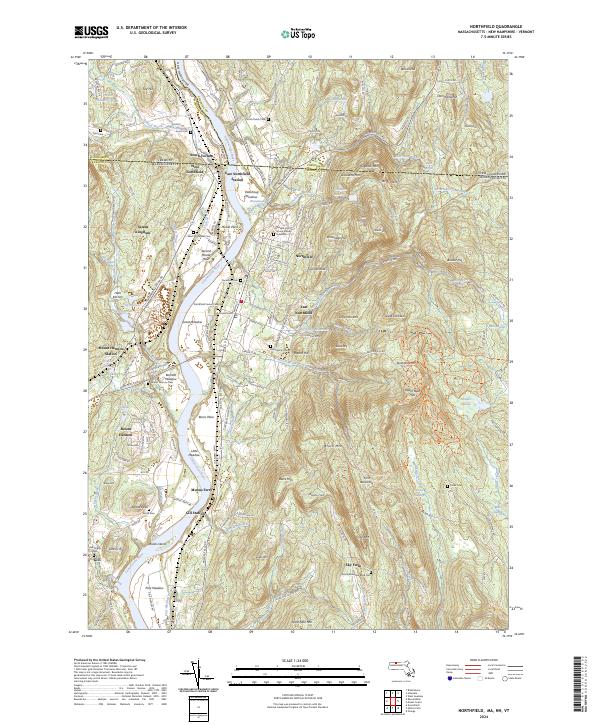
2024 Map of Northfield
USGS Topo · Published 2024About this map
Northfield and its surrounding tri-state borderlands are anchored by the winding course of the Connecticut River, which carves through a landscape of named flats and prominent ridges. The area is notable for its concentration of educational and religious history, particularly around Mount Hermon and the Dwight and Emma Moody Gravesite. The topography transitions from the low-lying Beers Plain and Great Meadow to the significant elevations of Brush Mtn and Northfield Mtn in the east.
Find a feature on this map
173 named features on this map. Tap any name to fly to it.
Don’t see what you’re looking for? This feature index may not catch every label — zoom into the map to look around manually.
Map Details
Editions of this 2024 Northfield Map
This is the sole edition of this map. No revisions or reprints were ever made.
Other maps of this area

1887 · Warwick
USGS Topo · 1:62,500

1889 · Warwick
USGS Topo · 1:62,500

1890 · Greenfield
USGS Topo · 1:62,500

1891 · Brattleboro
USGS Topo · 1:62,500

1893 · Brattleboro
USGS Topo · 1:62,500

1894 · Greenfield
USGS Topo · 1:62,500

1894 · Warwick
USGS Topo · 1:62,500

1898 · Keene
USGS Topo · 1:62,500

1932 · Brattleboro
USGS Topo · 1:48,000

1932 · Warwick
USGS Topo · 1:48,000