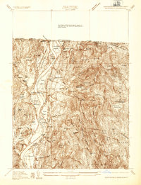
1936 Map of Northfield
USGS Topo · Published 1936About this map
The Connecticut River bisects this 1930s landscape, serving as a corridor for the Boston and Maine RR and the Central Vermont RY. The river valley is flanked by agricultural flats like Pauchaug Meadow and Great Meadow, which contrast sharply with the elevations of Brush Mountain and Satans Kingdom. This era shows a community in transition, featuring the Northfield OCCM Camp S 86 and the industrial presence of the Warwick Mill.
Find a feature on this map
95 named features on this map. Tap any name to fly to it.
Don’t see what you’re looking for? This feature index may not catch every label — zoom into the map to look around manually.
Map Details
Editions of this 1936 Northfield Map
This is the sole edition of this map. No revisions or reprints were ever made.
Other maps of this area

1887 · Warwick
USGS Topo · 1:62,500

1889 · Warwick
USGS Topo · 1:62,500

1890 · Greenfield
USGS Topo · 1:62,500

1891 · Brattleboro
USGS Topo · 1:62,500

1893 · Brattleboro
USGS Topo · 1:62,500

1894 · Greenfield
USGS Topo · 1:62,500

1894 · Warwick
USGS Topo · 1:62,500

1898 · Keene
USGS Topo · 1:62,500

1932 · Brattleboro
USGS Topo · 1:48,000

1932 · Warwick
USGS Topo · 1:48,000