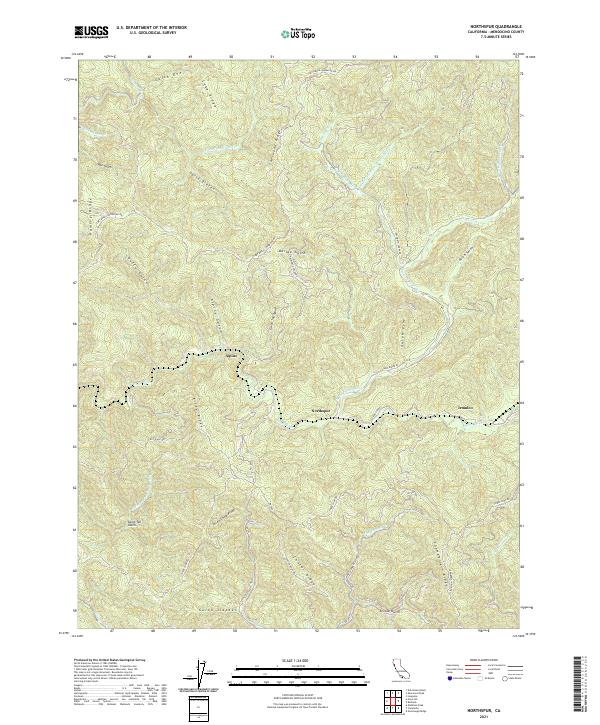
2021 Map of Northspur
USGS Topo · Published 2021About this map
Northspur and the winding Noyo River corridor define this region of the California Coast Ranges, where steep drainages and timbered ridges dictate the movement of roads and settlements. This 2021 survey shows a landscape deeply shaped by its logging and transit heritage, evidenced by locations such as Irmulco and the remote Alpine settlement. Long ridgelines like Sherwood Ridge and Chamberlain Ridge separate the various forks of the river system, while historical transportation corridors like the Fort Bragg-Sherwood Rd and Three Chop Rd follow the high ground to connect isolated valley outposts. The map reveals an intricate network of forestry roads and gulches, including Camp Ten Gulch and Arvola Gulch, providing a modern record of the geographic features that have supported the Mendocino county interior for generations.
Find a feature on this map
53 named features on this map. Tap any name to fly to it.
Don’t see what you’re looking for? This feature index may not catch every label — zoom into the map to look around manually.
Map Details
Editions of this 2021 Northspur Map
This is the sole edition of this map. No revisions or reprints were ever made.
Other maps of this area

1920 · Glenblair
USGS Topo · 1:62,500

1921 · Branscomb
USGS Topo · 1:62,500

1922 · Willits
USGS Topo · 1:62,500

1942 · Willits
USGS Topo · 1:62,500

1943 · Glenblair
USGS Topo · 1:62,500

1944 · Willits
USGS Topo · 1:62,500

1951 · Branscomb
USGS Topo · 1:62,500

1951 · Laytonville
USGS Topo · 1:62,500

1957 · Ukiah
USGS Topo · 1:250,000

1960 · Ukiah
USGS Topo · 1:250,000