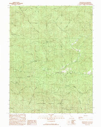
1991 Map of Northspur
USGS Topo · Published 1991About this map
Jackson State Forest dominates the southern landscape of this coastal California interior, where the Noyo River and its various forks carve through high ridges. This 1991 provisional edition captures a region defined by logging history and summer recreation, featuring several named camps such as Camp Mendocino, Camp Saint Albert, and Camp Noyo. The map documents the intricate network of gulches and creeks feeding the North Fork Noyo River, highlighting the difficult topography that dictated the placement of early settlements and routes. Distinctive landmarks like Three Chop Ridge and Sherwood Ridge flank the central river valleys. Smaller, perhaps more transient locations like Marble Place and Old Camp Seven provide valuable reference points for those tracing the industrial or family history of Mendocino County’s timberlands during the late 20th century.
Find a feature on this map
36 named features on this map. Tap any name to fly to it.
Don’t see what you’re looking for? This feature index may not catch every label — zoom into the map to look around manually.
Map Details
Editions of this 1991 Northspur Map
This is the sole edition of this map. No revisions or reprints were ever made.
Other maps of this area

1920 · Glenblair
USGS Topo · 1:62,500

1921 · Branscomb
USGS Topo · 1:62,500

1922 · Willits
USGS Topo · 1:62,500

1942 · Willits
USGS Topo · 1:62,500

1943 · Glenblair
USGS Topo · 1:62,500

1944 · Willits
USGS Topo · 1:62,500

1951 · Branscomb
USGS Topo · 1:62,500

1951 · Laytonville
USGS Topo · 1:62,500

1957 · Ukiah
USGS Topo · 1:250,000

1960 · Ukiah
USGS Topo · 1:250,000