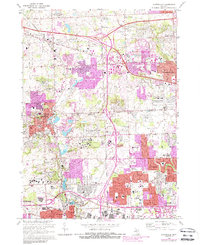
2023 Map of Northville
USGS Topo · Published 2023About this map
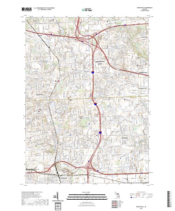
Northville and its surrounding suburbs in Oakland and Wayne counties reveal an intricate network of residential expansion and early 21st-century infrastructure. The landscape is defined by the headwaters of the Rouge River system, including the Middle River Rouge, Upper River Rouge, and the Walled Lake Branch. While modern development is widespread, the map preserves the location of numerous historic burial grounds such as Rural Hill Cem and the Quaker Cem, reflecting the area's 19th-century pioneer foundations. Educational hubs like Schoolcraft College and Madonna University anchor the eastern sectors, while water bodies such as Phoenix Lake and Wilcox Lake provide focal points for local geography. The grid of major mile roads, from 8 Mile Rd to 12 Mile Rd, structures the transit patterns of Farmington Hills, Novi, and Livonia.
Find a feature on this map
59 named features on this map. Tap any name to fly to it.
Don’t see what you’re looking for? This feature index may not catch every label — zoom into the map to look around manually.
Map Details
Editions of this 2023 Northville Map
This is the sole edition of this map. No revisions or reprints were ever made.
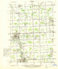
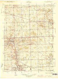
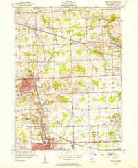
Historical Maps of Northville Through Time
5 maps found