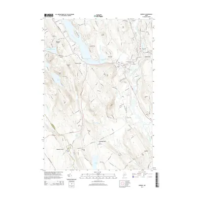
2014 Map of Norway
USGS Topo · Published 2014About this map
Pennesseewassee Lake and its smaller counterpart, Little Pennesseewassee Pond, dominate the western landscape of this Oxford County region. The eastern corridor follows the Little Androscoggin River, where the settlement of South Paris sits just across from the town of Norway. This 2014 survey documents the established local infrastructure of the early 21st century, including the Central Maine Community College Paris campus and a dense network of roads linking outlying hamlets like Norway Center, Otisfield Gore, and Stuarts Corner.
Find a feature on this map
157 named features on this map. Tap any name to fly to it.
Don’t see what you’re looking for? This feature index may not catch every label — zoom into the map to look around manually.
Map Details
Editions of this 2014 Norway Map
This is the sole edition of this map. No revisions or reprints were ever made.
Other maps of this area

1896 · Norway
USGS Topo · 1:62,500

1908 · Poland
USGS Topo · 1:62,500

1911 · Bryant Pond
USGS Topo · 1:62,500

1911 · Buckfield
USGS Topo · 1:62,500

1913 · Buckfield
USGS Topo · 1:62,500

1914 · Bryant Pond
USGS Topo · 1:62,500

1940 · Poland
USGS Topo · 1:62,500

1942 · Buckfield
USGS Topo · 1:62,500

1942 · Bryant Pond
USGS Topo · 1:62,500

1942 · Poland
USGS Topo · 1:62,500