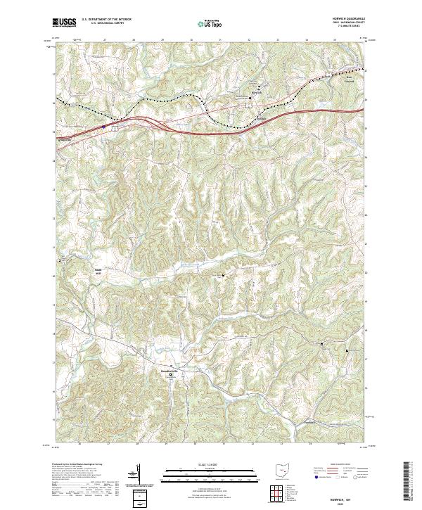
2023 Map of Norwich
USGS Topo · Published 2023About this map
Chandlersville and Norwich serve as the primary anchors for this area of Muskingum County, where the landscape is defined by the winding paths of Salt Creek and White Eyes Creek. The settlement pattern reflects an older agricultural and mill-based economy, evidenced by locations like Smith Mill and the cluster of crossroads communities such as Sundale and Bridgeville. The terrain is notably dissected by numerous waterways including Williams Fork and Buffalo Fork, which carve through the high ground of Coon Ridge. Genealogists will find significant value in the documentation of several local burial grounds, ranging from the Norwich United Presbyterian Cem in the north to the Rich Hill Cem and Salt Creek Cem in the south. The road network, featuring legacy routes like East Pike and Clay Pike, connects these historically distinct townships, illustrating the persistent importance of early transport corridors in southeast Ohio.
Find a feature on this map
111 named features on this map. Tap any name to fly to it.
Don’t see what you’re looking for? This feature index may not catch every label — zoom into the map to look around manually.
Map Details
Editions of this 2023 Norwich Map
This is the sole edition of this map. No revisions or reprints were ever made.
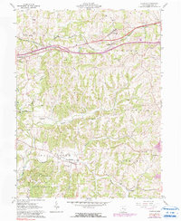
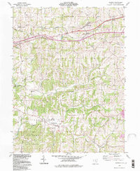
Historical Maps of Norwich Through Time
3 maps found