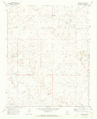
1970 Map of Nose Rock
USGS Topo · Published 1973About this map
Nose Rock serves as a prominent natural landmark in this high-desert landscape of McKinley County, as surveyed in the late 1960s. The terrain is defined by the complex drainage systems of Kin Klizhin Wash and Kim-me-ni-oli Wash, which cut through the arid plains. Evidence of mid-century land management and resource exploration is scattered across the map, from the systematic naming of watering points like Windmill No 5 and Windmill No 6 to the presence of a Well and a dedicated Spillway. These features, along with several marked Drill Holes, reflect the intersection of traditional grazing practices and modern industrial prospecting in northwestern New Mexico. The lack of concentrated settlements underscores the vast, open character of this region during the 1970 publication era.
Find a feature on this map
8 named features on this map. Tap any name to fly to it.
Don’t see what you’re looking for? This feature index may not catch every label — zoom into the map to look around manually.
Map Details
Editions of this 1970 Nose Rock Map
This is the sole edition of this map. No revisions or reprints were ever made.
Other maps of this area

1883 · Mt. Taylor
USGS Topo · 1:250,000

1886 · Wingate
USGS Topo · 1:250,000

1886 · Mt. Taylor
USGS Topo · 1:250,000

1889 · Largo
USGS Topo · 1:250,000

1889 · Chaco
USGS Topo · 1:250,000

1892 · Wingate
USGS Topo · 1:250,000

1892 · Chaco
USGS Topo · 1:250,000

1892 · Mt. Taylor
USGS Topo · 1:250,000

1895 · Largo
USGS Topo · 1:250,000

1899 · Mt. Taylor
USGS Topo · 1:250,000