2022 Map of Nowthen
USGS Topo · Published 2022About this map
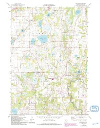
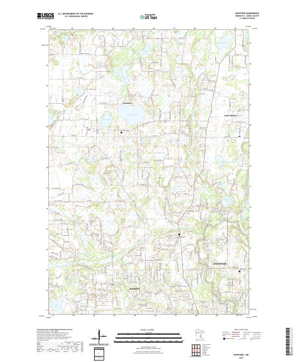
The settlement of Nowthen serves as the focal point for this survey of northwestern Anoka County, where the transition between lake-studded woodlands and suburban expansion is clearly visible. The landscape is defined by its glacial hydrology, with numerous water bodies like Pickerel Lake, Pinnaker Lake, and Goose Lake scattered across the township lines. The southern portion of the map shows the residential growth of Ramsey and Andover, organized around a strict grid of numeric avenues and lanes. The winding course of the Rum River and Trott Brook provide a natural contrast to the geometric road network, which includes historic routes like Old Viking Blvd NW. For the local historian, the map identifies three distinct burial sites: Lakeview Cem, Trott Brook Cem, and Staples Cem, marking the early centers of community and family life in these rural townships.
Find a feature on this map
94 named features on this map. Tap any name to fly to it.
Don’t see what you’re looking for? This feature index may not catch every label — zoom into the map to look around manually.
Map Details
Editions of this 2022 Nowthen Map
This is the sole edition of this map. No revisions or reprints were ever made.