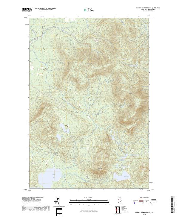
2024 Map of Number Four Mountain
USGS Topo · Published 2024About this map
Number Four Mtn and Lily Bay Mtn dominate this high-elevation landscape in Piscataquis County, where a complex network of brooks feeds several secluded ponds. This modern survey illustrates the hydrology of the North Woods, showing how Lily Bay Brook and Meadow Brook drain the northern slopes toward the boundary of Baxter State Park Rd. To the south, the terrain descends toward Upper Wilson Pond, a significant water body fed by South Brook and Mountain Brook. The map reveals the intricate placement of smaller waters like Baker Pond and Pearl Ponds, which are positioned between the steep rises of Elephant Mtn and Baker Mtn. The lack of dense settlement is evident, with only a few corridors such as Frenchtown Rd and Scammon Rd providing access to this wilderness area, highlighting the region's character as a site for conservation and back-country recreation.
Find a feature on this map
26 named features on this map. Tap any name to fly to it.
Don’t see what you’re looking for? This feature index may not catch every label — zoom into the map to look around manually.
Map Details
Editions of this 2024 Number Four Mountain Map
This is the sole edition of this map. No revisions or reprints were ever made.
Other maps of this area

1920 · Moosehead Lake
USGS Topo · 1:62,500

1922 · Moosehead Lake
USGS Topo · 1:62,500

1930 · Moosehead Lake
USGS Topo · 1:62,500

1944 · Moosehead Lake
USGS Topo · 1:62,500

1950 · Sebec Lake
USGS Topo · 1:62,500

1951 · Greenville
USGS Topo · 1:62,500

1952 · First Roach Pond
USGS Topo · 1:62,500

1954 · Millinocket
USGS Topo · 1:250,000

1957 · Moosehead Lake
USGS Topo · 1:62,500

1958 · Millinocket
USGS Topo · 1:250,000
Featured Places
- Greenville, ME
- Beaver Cove, ME
- Frenchtown Township, ME
- Lily Bay Township, ME
- Bowdoin College Grant East Township, ME