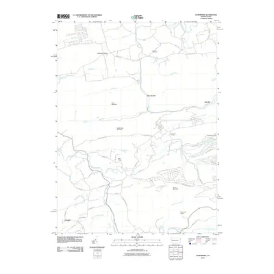
2010 Map of Nuremberg
USGS Topo · Published 2010About this map
Mountain Grove and Ferndale anchor this portion of the Pennsylvania landscape, where the terrain is defined by the significant elevations of Buck Mountain, South Buck Mountain, and Green Mountain. The drainage patterns are intricate, with Catawissa Creek and its many tributaries, such as Little Catawissa Creek and Dark Run, carving through the ridges. The presence of McDonalds Airport and Sugarloaf Golf Course indicates modern land use alongside more traditional landmarks like the Nuremberg Cemetery. Water management and natural features are central to the area's character, evidenced by the Lake Susquehanna Dam and the cascading waters at Tomhicken Falls. The road network, including State Rd and Buck Mountain Rd, connects these small communities and natural landmarks, providing a clear picture of the region's rural development and topography at the start of the twenty-first century.
Find a feature on this map
71 named features on this map. Tap any name to fly to it.
Don’t see what you’re looking for? This feature index may not catch every label — zoom into the map to look around manually.
Map Details
Editions of this 2010 Nuremberg Map
This is the sole edition of this map. No revisions or reprints were ever made.
Other maps of this area

1889 · Catawissa
USGS Topo · 1:62,500

1892 · Catawissa
USGS Topo · 1:62,500

1892 · Mahanoy
USGS Topo · 1:62,500

1893 · Mahanoy
USGS Topo · 1:62,500

1894 · Catawissa
USGS Topo · 1:62,500

1894 · Shickshinny
USGS Topo · 1:62,500

1894 · Bloomsburg
USGS Topo · 1:62,500

1946 · Sybertsville
USGS Topo · 1:31,680

1946 · Berwick
USGS Topo · 1:31,680

1947 · Ashland
USGS Topo · 1:24,000
Featured Places
- Monticello, Beaver Township
- Gowen, Black Creek Township
- Gum Run, Black Creek Township
- Sugarloaf Township, PA
- Gowen Breaker Station, Black Creek Township