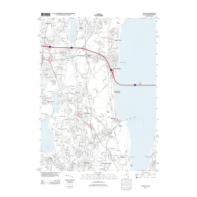
2013 Map of Nyack
USGS Topo · Published 2013About this map
Nyack and the lower reach of the Hudson River define this riverside corridor as it appeared in the early 2010s. The landscape is characterized by a dense network of suburban hamlets like Valley Cottage, West Nyack, and Orangeburg that are knit together by major infrastructure. The Tappan Zee Bridge spans the river, connecting these Rockland County communities to the eastern shore, while the Hackensack River feeds into DeForest Lake and Lake Tappan further west.
Find a feature on this map
54 named features on this map. Tap any name to fly to it.
Don’t see what you’re looking for? This feature index may not catch every label — zoom into the map to look around manually.
Map Details
Editions of this 2013 Nyack Map
This is the sole edition of this map. No revisions or reprints were ever made.
Other maps of this area

1888 · Paterson
USGS Topo · 1:62,500

1891 · Ramapo
USGS Topo · 1:62,500

1891 · Harlem
USGS Topo · 1:62,500

1892 · Paterson
USGS Topo · 1:62,500

1892 · Tarrytown
USGS Topo · 1:62,500

1893 · Tarrytown
USGS Topo · 1:62,500

1893 · Ramapo
USGS Topo · 1:62,500

1897 · Harlem
USGS Topo · 1:62,500

1898 · Harlem
USGS Topo · 1:62,500

1898 · Paterson
USGS Topo · 1:62,500