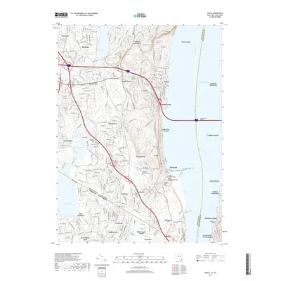
2019 Map of Nyack
USGS Topo · Published 2019About this map
The Hudson River defines the eastern boundary of this region, separating the riverfront villages of Nyack, South Nyack, and Piermont from the Westchester side's Tarrytown and Sleepy Hollow. Connected by the massive Tappan Zee Bridge, these communities sit on a complex landscape of glacial hills and managed water, including the large reservoirs of DeForest Lake and Lake Tappan. The map captures a high density of institutional and educational sites, from Dominican College and Saint Thomas Aquinas College to the sprawling Rockland Psychiatric Center near Orangeburg.
Find a feature on this map
64 named features on this map. Tap any name to fly to it.
Don’t see what you’re looking for? This feature index may not catch every label — zoom into the map to look around manually.
Map Details
Editions of this 2019 Nyack Map
This is the sole edition of this map. No revisions or reprints were ever made.
Other maps of this area

1888 · Paterson
USGS Topo · 1:62,500

1891 · Ramapo
USGS Topo · 1:62,500

1891 · Harlem
USGS Topo · 1:62,500

1892 · Paterson
USGS Topo · 1:62,500

1892 · Tarrytown
USGS Topo · 1:62,500

1893 · Tarrytown
USGS Topo · 1:62,500

1893 · Ramapo
USGS Topo · 1:62,500

1897 · Harlem
USGS Topo · 1:62,500

1898 · Harlem
USGS Topo · 1:62,500

1898 · Paterson
USGS Topo · 1:62,500