2023 Map of Nyack
USGS Topo · Published 2023About this map
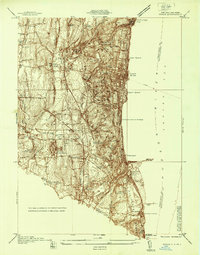
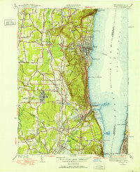
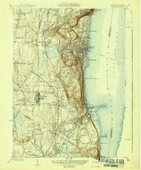
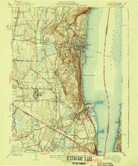
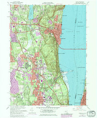
The Hudson River defines the eastern edge of this Rockland County corridor, where the steep elevations of Hook Mountain and Tallman Mountain drop toward the riverside villages of Nyack, Piermont, and Grand View-on-Hudson. Inland, the landscape is shaped by the sprawling waters of DeForest Lake and Lake Tappan, connected by the Hackensack River. The map reveals a dense suburban and institutional character, notably featuring several major educational grounds such as the Nyack College Rockland Campus and Saint Thomas Aquinas College. Genealogists will find a high concentration of burial sites, including the historic Oak Hill Cem, Nyack Rural Cem, and Mount Moor Cem. The southern portion of the sheet crosses the New York New Jersey state line into Bergen County, encompassing communities like Northvale and Tappan, while the CSX railroad corridor provides a modern industrial link through the heart of the valley.
Find a feature on this map
301 named features on this map. Tap any name to fly to it.
Don’t see what you’re looking for? This feature index may not catch every label — zoom into the map to look around manually.
Map Details
Editions of this 2023 Nyack Map
This is the sole edition of this map. No revisions or reprints were ever made.
Historical Maps of Hastings-on-Hudson Through Time
7 maps found