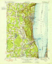
1940 Map of Nyack
USGS Topo · Published 1952About this map
Tappan Zee and the Hudson River dominate the eastern edge of this 1940 survey, framing a landscape of evolving transportation and institutional growth. The interior reveals a dense network of rail lines, including the West Shore RR and the Erie RR, which connected established river towns like Nyack and Piermont to the inland hamlets of Blauvelt and Orangeburg. The map documents significant land use patterns of the era, from the sprawling grounds of the Rockland State Hospital to recreational sites like the Clarkstown Country Club and the Rifle Range.
Find a feature on this map
81 named features on this map. Tap any name to fly to it.
Don’t see what you’re looking for? This feature index may not catch every label — zoom into the map to look around manually.
Map Details
Editions of this 1940 Nyack Map
This is the sole edition of this map. No revisions or reprints were ever made.
Other maps of this area

1888 · Paterson
USGS Topo · 1:62,500

1891 · Ramapo
USGS Topo · 1:62,500

1891 · Harlem
USGS Topo · 1:62,500

1892 · Paterson
USGS Topo · 1:62,500

1892 · Tarrytown
USGS Topo · 1:62,500

1893 · Tarrytown
USGS Topo · 1:62,500

1893 · Ramapo
USGS Topo · 1:62,500

1897 · Harlem
USGS Topo · 1:62,500

1898 · Harlem
USGS Topo · 1:62,500

1898 · Paterson
USGS Topo · 1:62,500