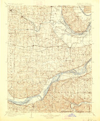
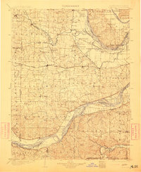
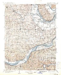
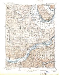
1903 Map of O'Fallon
USGS Topo · Published 1927About this map
The confluence of the Mississippi River and Illinois River near Grafton dominates the northern reaches of this landscape, while the Missouri River carves its path across the southern section. This intricate riverine geography supported a complex network of 19th-century river-and-rail commerce, with the Wabash R. R. and Missouri Pacific R. R. connecting riverside towns to the interior. Small farming communities such as Femme Osage, Schluersburg, and Cottleville dot the plains between the major watercourses.
Find a feature on this map
112 named features on this map. Tap any name to fly to it.
Don’t see what you’re looking for? This feature index may not catch every label — zoom into the map to look around manually.
Map Details
Editions of this 1903 O'Fallon Map
5 editions found
Other maps of this area

1890 · Louisiana
USGS Topo · 1:125,000

1890 · Hermann
USGS Topo · 1:125,000

1901 · De Soto
USGS Topo · 1:125,000

1903 · O'Fallon
USGS Topo · 1:125,000

1903 · Sullivan
USGS Topo · 1:125,000

1912 · Kimmswick
USGS Topo · 1:62,500

1916 · Kimmswick
USGS Topo · 1:62,500

1924 · Robertson
USGS Topo · 1:24,000

1927 · St. Charles
USGS Topo · 1:62,500

1930 · Hardin
USGS Topo · 1:62,500