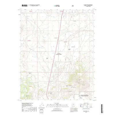
2018 Map of O'Leary Peak
USGS Topo · Published 2018About this map
O'Leary Peak and the volcanic terrain of Sunset Crater Volcano National Monument dominate this portion of the Coconino National Forest. The landscape is a complex assembly of cinder cones and ancient flows, featuring Robinson Crater, Robinson Mtn, and the sprawling Bonita Lava Flow. The presence of numerous livestock tanks, such as Old Grand Canyon Tank and Chicos Tank, indicates a long history of high-altitude ranching and water management in a region defined by porous volcanic soils. These features are connected by a network of forest roads and trails, including the O'Leary Trail 545a, which skirts Darton Dome. Further west, the slopes of San Francisco Mtn rise above Bear Jaw Canyon, while high valleys like Medicine Valley and Sinagua Valley suggest the archaeological and geomorphic depth of this northern Arizona highlands area.
Find a feature on this map
41 named features on this map. Tap any name to fly to it.
Don’t see what you’re looking for? This feature index may not catch every label — zoom into the map to look around manually.
Map Details
Editions of this 2018 O'Leary Peak Map
This is the sole edition of this map. No revisions or reprints were ever made.
Other maps of this area
1886 · San Francisco Mtns
USGS Topo · 1:250,000
1891 · San Francisco Mtns
USGS Topo · 1:250,000
1894 · San Francisco Mtns
USGS Topo · 1:250,000
1899 · San Francisco Mtns
USGS Topo · 1:250,000
1908 · Flagstaff
USGS Topo · 1:125,000
1912 · Flagstaff
USGS Topo · 1:125,000

1947 · Flagstaff
USGS Topo · 1:250,000
1954 · Flagstaff
USGS Topo · 1:250,000
1958 · Flagstaff
USGS Topo · 1:250,000
1960 · Flagstaff
USGS Topo · 1:250,000