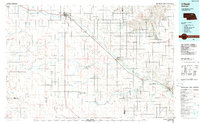
1985 Map of O'Neill
USGS Topo · Published 1988About this map
The Elkhorn River valley serves as the primary corridor for settlement and transit across this portion of northern Nebraska in the mid-1980s. Anchored by the town of O'Neill, the landscape is defined by the braided path of the river and its many tributaries, including Antelope Creek and Cache Creek. The terrain transitions from the broader expanse of Buffalo Flats to more concentrated drainage networks around Neligh. Extensive water features such as Swan Lake, West Lake, and Welsh Lake suggest a region rich in wetlands, further evidenced by the Goose Lake State Wildlife Management Area. Numerous small communities like Amelia, Ewing, and Chambers are connected by a network of rural roads and localized aviation hubs such as Perkins Memorial Airpark. Industrial activity is noted through several specific sites, including a Claypit and a Quarry, reflecting the local extraction of natural resources.
Find a feature on this map
47 named features on this map. Tap any name to fly to it.
Don’t see what you’re looking for? This feature index may not catch every label — zoom into the map to look around manually.
Map Details
Editions of this 1985 O'Neill Map
2 editions found
Other maps of this area

1952 · Burwell NE
USGS Topo · 1:24,000

1954 · Atkinson SE
USGS Topo · 1:24,000

1954 · Atkinson
USGS Topo · 1:24,000

1954 · Stuart SE
USGS Topo · 1:24,000

1954 · Gables NW
USGS Topo · 1:24,000

1954 · Walnut
USGS Topo · 1:24,000

1954 · Dorsey SW
USGS Topo · 1:24,000

1954 · Bartlett NW
USGS Topo · 1:24,000

1954 · Opportunity
USGS Topo · 1:24,000

1954 · Meek SW
USGS Topo · 1:24,000