
1952 Map of Oakes
USGS Topo · Published 1954About this map
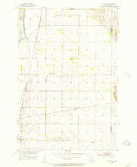
The railroad town of Oakes serves as a major hub in the early 1950s, defined by the intersection of three distinct rail lines: the Northern Pacific, the Minneapolis St Paul and Sault Ste Marie, and the C & N W. This intersection created a dense grid of residential and commercial development near the southern edge of the map, supported by civic infrastructure like the Town Hall. To the west, the James River meanders past the town site, while Bear Creek cuts through the central sections of Bear Creek and Divide townships. The landscape is dotted with early rural educational centers including School No 1, School No 2, and School No 4. This survey also documents local recreation and industry, from the Oakes Golf Club to several Gravel Pits and numerous flowing wells and windmills essential for prairie agriculture.
Find a feature on this map
20 named features on this map. Tap any name to fly to it.
Don’t see what you’re looking for? This feature index may not catch every label — zoom into the map to look around manually.
Map Details
Editions of this 1952 Oakes Map
This is the sole edition of this map. No revisions or reprints were ever made.
Other maps of this area

1894 · Oakes
USGS Topo · 1:62,500

1895 · Lamoure
USGS Topo · 1:125,000

1918 · La Moure
USGS Topo · 1:125,000

1952 · Glover
USGS Topo · 1:24,000

1952 · Crete
USGS Topo · 1:24,000

1952 · Independence
USGS Topo · 1:24,000

1953 · Jamestown
USGS Topo · 1:250,000

1953 · Fargo
USGS Topo · 1:250,000
1955 · Oakes SE
USGS Topo · 1:24,000
1955 · Guelph
USGS Topo · 1:24,000