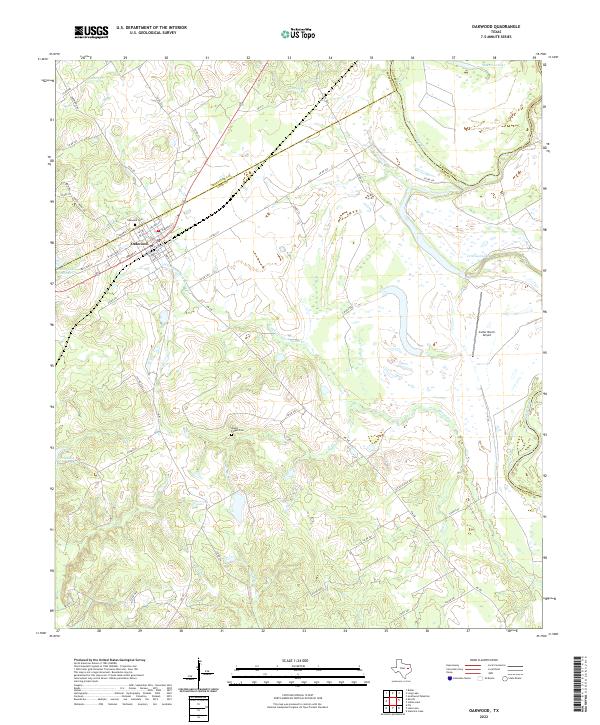
2022 Map of Oakwood
USGS Topo · Published 2022About this map
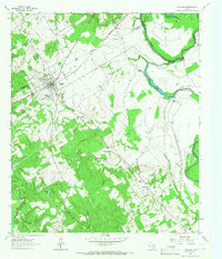
Oakwood serves as the primary hub of this East Texas landscape, where the town grid is defined by streets like Broad St and Kimbell St. The community's history is anchored by the Oakwood Cem to the north, while the surrounding Leon County countryside is marked by smaller family and community landmarks such as Mount Pisgah Cem near Mount Pisgah. This 2022 survey captures a terrain defined by its complex hydrology, with the Trinity River forming the eastern boundary and several oxbow-style lakes like McCrakin Lake and Criminal Lake dotting the bottomlands.
Find a feature on this map
62 named features on this map. Tap any name to fly to it.
Don’t see what you’re looking for? This feature index may not catch every label — zoom into the map to look around manually.
Map Details
Editions of this 2022 Oakwood Map
This is the sole edition of this map. No revisions or reprints were ever made.