2023 Map of Oakwood
USGS Topo · Published 2023About this map
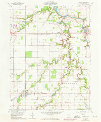
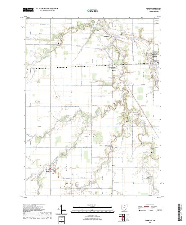
The Auglaize River and its numerous tributaries, including the Little Auglaize River and Prairie Creek, define the landscape of this Paulding County region. The settlement of Oakwood serves as a primary hub in the northeast, while smaller communities like Melrose, Roselms, and Grover Hill anchor the surrounding agricultural grid. This modern survey illustrates a deeply rooted rural layout where family and community heritage is preserved through a high density of small burial grounds. Genealogists will find an exceptional number of documented sites, such as Kingery Cem, Bowholtz Cem, and Hertel Cem. The presence of the North Country National Scenic Trl cutting through the eastern sections reflects contemporary land use alongside historic landmarks like Fort Brown. Significant water features like Burt Lake and the West Branch Prairie Creek continue to shape the local geography within the township divisions of t2n r4e and t1n r3e.
Find a feature on this map
94 named features on this map. Tap any name to fly to it.
Don’t see what you’re looking for? This feature index may not catch every label — zoom into the map to look around manually.
Map Details
Editions of this 2023 Oakwood Map
This is the sole edition of this map. No revisions or reprints were ever made.