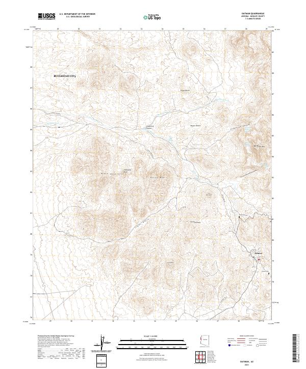
2021 Map of Oatman
USGS Topo · Published 2021About this map
Oatman remains a focal point of this arid landscape, situated at the eastern edge of the Black Mountains. The settlement is closely tied to its mining history, evidenced by the nearby Gold Road Cem and Oatman Cem. The terrain is defined by dramatic volcanic features and ridges, including Hardy Mtn, Cathedral Rock, and the prominent Battleship Mtn. To the northwest, the edge of Bullhead City begins to appear, signaling the transition toward the Colorado River valley. Seasonal drainage patterns are inscribed across the Mojave Desert floor by numerous desert washes such as Silver Creek Wash, Montana Wash, and Mossback Wash. These dry channels, along with vital water sources like Grapevine Canyon Spring and Whiskey Spring, dictate the movement and survival patterns in this corner of the Black Mountain range.
Find a feature on this map
31 named features on this map. Tap any name to fly to it.
Don’t see what you’re looking for? This feature index may not catch every label — zoom into the map to look around manually.
Map Details
Editions of this 2021 Oatman Map
This is the sole edition of this map. No revisions or reprints were ever made.
Other maps of this area

1886 · Camp Mohave
USGS Topo · 1:250,000

1892 · Camp Mohave
USGS Topo · 1:250,000

1903 · Needles
USGS Topo · 1:125,000

1904 · Needles Special
USGS Topo · 1:125,000

1926 · Mohave City
USGS Topo · 1:96,000

1942 · Camp Mohave
USGS Topo · 1:250,000

1947 · Kingman
USGS Topo · 1:250,000

1948 · Kingman
USGS Topo · 1:250,000

1950 · Davis Dam
USGS Topo · 1:62,500

1950 · Needles
USGS Topo · 1:62,500