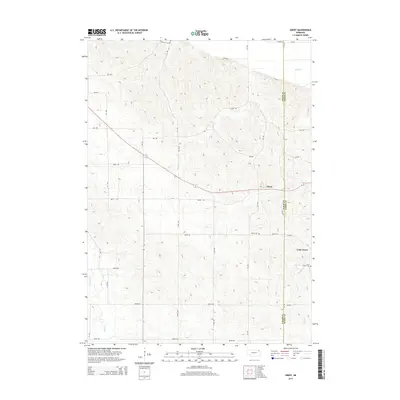
2014 Map of Obert
USGS Topo · Published 2014About this map
The village of Obert sits at the heart of this Cedar County landscape, where the agricultural grid meets a terrain sculpted by the drainage of several local waterways. The northeastern portion of the map is defined by Ames Cr, while the southern reaches are marked by the winding paths of Lime Cr and the branches of East Bow Cr, also labeled as E Bow Cr. This survey illustrates the proximity between the central settlement of Obert and the community of Lime Grove to the southeast. For researchers and genealogists, the inclusion of the Obert Cem and the Lime Creek Cem provides critical points for family history. The boundary between Cedar Co and Dixon Co runs along the eastern edge of the quadrangle, reflecting the administrative lines that have shaped land ownership in this part of Nebraska.
Find a feature on this map
28 named features on this map. Tap any name to fly to it.
Don’t see what you’re looking for? This feature index may not catch every label — zoom into the map to look around manually.
Map Details
Editions of this 2014 Obert Map
This is the sole edition of this map. No revisions or reprints were ever made.
Other maps of this area

1898 · Elk Point
USGS Topo · 1:125,000

1901 · Elk Point
USGS Topo · 1:125,000

1907 · Elk Point
USGS Topo · 1:125,000

1955 · Sioux City
USGS Topo · 1:250,000

1958 · Sioux City
USGS Topo · 1:250,000

1959 · Sioux City
USGS Topo · 1:250,000

1964 · Martinsburg SW
USGS Topo · 1:24,000

1964 · Maskell
USGS Topo · 1:24,000

1968 · Obert
USGS Topo · 1:24,000

1968 · St. Helena
USGS Topo · 1:24,000