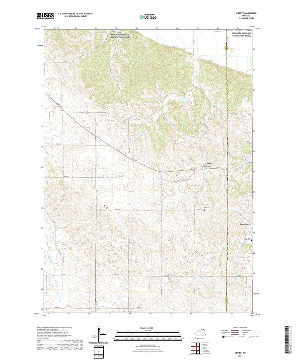
2021 Map of Obert
USGS Topo · Published 2021About this map
Obert and the nearby settlement of Lime Grove occupy a landscape of rolling hills and creek valleys in northern Cedar and Dixon counties. This area is defined by its rural road network, with numbered routes like 890th Rd and 572 Ave carving a grid across the dissected terrain. To the north, the Missouri National Recreation River marks the boundary of the state, flanked by intricate drainage systems including Ames Cr and East Bow Creek.
Find a feature on this map
37 named features on this map. Tap any name to fly to it.
Don’t see what you’re looking for? This feature index may not catch every label — zoom into the map to look around manually.
Map Details
Editions of this 2021 Obert Map
This is the sole edition of this map. No revisions or reprints were ever made.
Other maps of this area

1898 · Elk Point
USGS Topo · 1:125,000

1901 · Elk Point
USGS Topo · 1:125,000

1907 · Elk Point
USGS Topo · 1:125,000

1955 · Sioux City
USGS Topo · 1:250,000

1958 · Sioux City
USGS Topo · 1:250,000

1959 · Sioux City
USGS Topo · 1:250,000

1964 · Martinsburg SW
USGS Topo · 1:24,000

1964 · Maskell
USGS Topo · 1:24,000

1968 · Obert
USGS Topo · 1:24,000

1968 · St. Helena
USGS Topo · 1:24,000