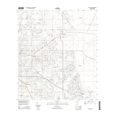
2015 Map of Ocala East
USGS Topo · Published 2015About this map
Ocala and its eastern surroundings are depicted here during a period of significant suburban expansion, where residential street grids increasingly weave through the karst topography and citrus-growing heritage of Marion County. The map is anchored by the natural wonders of Silver Springs, with the Silver River flowing eastward across the landscape. The layout of the city reveals a concentration of legacy sites, particularly in the vicinity of the Fort King Burial Grounds, which marks the vicinity of an influential 19th-century military outpost.
Find a feature on this map
154 named features on this map. Tap any name to fly to it.
Don’t see what you’re looking for? This feature index may not catch every label — zoom into the map to look around manually.
Map Details
Editions of this 2015 Ocala East Map
This is the sole edition of this map. No revisions or reprints were ever made.
Other maps of this area

1893 · Citra
USGS Topo · 1:62,500

1895 · Citra
USGS Topo · 1:62,500

1895 · Ocala
USGS Topo · 1:62,500

1954 · Gainesville
USGS Topo · 1:250,000

1954 · Daytona Beach
USGS Topo · 1:250,000

1958 · Daytona Beach
USGS Topo · 1:250,000

1958 · Gainesville
USGS Topo · 1:250,000

1959 · Gainesville
USGS Topo · 1:250,000

1964 · Daytona Beach
USGS Topo · 1:250,000
1967 · Ocala East
USGS Topo · 1:24,000