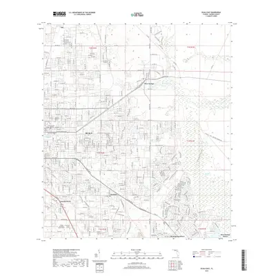
2018 Map of Ocala East
USGS Topo · Published 2018About this map
Fort King Burial Grounds sits as a significant historical marker on the eastern side of Ocala, preserving the legacy of the area's early frontier history. The landscape transitions from the urban street grid of the city to the dense wetlands of Marshall Swamp and the headwaters of the Silver River. This 2018 survey reveals the extensive modern residential developments around Silver Springs Shores, contrasted with the established community of Silver Springs and the older settlement at Montague.
Find a feature on this map
82 named features on this map. Tap any name to fly to it.
Don’t see what you’re looking for? This feature index may not catch every label — zoom into the map to look around manually.
Map Details
Editions of this 2018 Ocala East Map
This is the sole edition of this map. No revisions or reprints were ever made.
Other maps of this area

1893 · Citra
USGS Topo · 1:62,500

1895 · Citra
USGS Topo · 1:62,500

1895 · Ocala
USGS Topo · 1:62,500

1954 · Gainesville
USGS Topo · 1:250,000

1954 · Daytona Beach
USGS Topo · 1:250,000

1958 · Daytona Beach
USGS Topo · 1:250,000

1958 · Gainesville
USGS Topo · 1:250,000

1959 · Gainesville
USGS Topo · 1:250,000

1964 · Daytona Beach
USGS Topo · 1:250,000
1967 · Ocala East
USGS Topo · 1:24,000