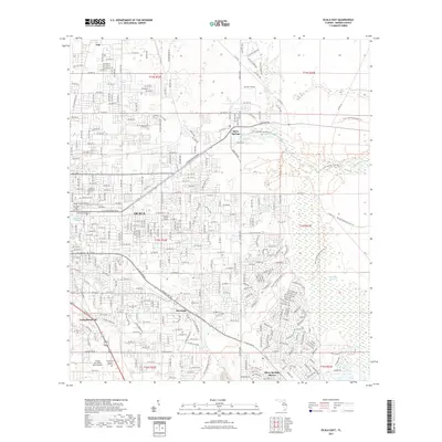
2021 Map of Ocala East
USGS Topo · Published 2021About this map
Silver Springs and the eastern expansion of Ocala define this interior Florida landscape. The map highlights the transition from urban centers to significant natural and historical landmarks, including the notable Fort King Burial Grounds situated near the historic military site. The hydrology is dominated by the headwaters of the Silver River and the broad Marshall Swamp, illustrating the area's characteristic wetlands and spring-fed systems. Residential developments like Silver Springs Shores and Montague sit alongside large-scale recreation and utility areas such as Camp Roosevelt. For local historians and genealogists, the density of memorial sites is significant, featuring Woodlawn Cem, Greenwood Cem, and Forest Lawn Memory Gardens. The transport network includes the extensive Florida National Scenic Trail and the Cross Florida Greenway Trail, reflecting the modern repurposing of the landscape for conservation.
Find a feature on this map
40 named features on this map. Tap any name to fly to it.
Don’t see what you’re looking for? This feature index may not catch every label — zoom into the map to look around manually.
Map Details
Editions of this 2021 Ocala East Map
This is the sole edition of this map. No revisions or reprints were ever made.
Other maps of this area

1893 · Citra
USGS Topo · 1:62,500

1895 · Citra
USGS Topo · 1:62,500

1895 · Ocala
USGS Topo · 1:62,500

1954 · Gainesville
USGS Topo · 1:250,000

1954 · Daytona Beach
USGS Topo · 1:250,000

1958 · Daytona Beach
USGS Topo · 1:250,000

1958 · Gainesville
USGS Topo · 1:250,000

1959 · Gainesville
USGS Topo · 1:250,000

1964 · Daytona Beach
USGS Topo · 1:250,000
1967 · Ocala East
USGS Topo · 1:24,000