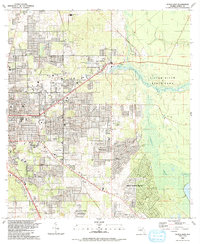
1991 Map of Ocala East
USGS Topo · Published 1991About this map
Silver Springs serves as the centerpiece of this eastern Florida landscape, where the Silver River flows eastward through the extensive Silver River State Park. This 1991 revision captures the significant suburban expansion of Ocala and the development of communities like Silver Springs Shores and Huntington. The transition from the urban grid to the wetlands of the Marshall Swamp is marked by a complex network of residential streets and recreational facilities, including the Jervey Gantt Sports Complex and the Appleton Culture Center.
Find a feature on this map
90 named features on this map. Tap any name to fly to it.
Don’t see what you’re looking for? This feature index may not catch every label — zoom into the map to look around manually.
Map Details
Editions of this 1991 Ocala East Map
This is the sole edition of this map. No revisions or reprints were ever made.
Other maps of this area

1893 · Citra
USGS Topo · 1:62,500

1895 · Citra
USGS Topo · 1:62,500

1895 · Ocala
USGS Topo · 1:62,500

1954 · Gainesville
USGS Topo · 1:250,000

1954 · Daytona Beach
USGS Topo · 1:250,000

1958 · Daytona Beach
USGS Topo · 1:250,000

1958 · Gainesville
USGS Topo · 1:250,000

1959 · Gainesville
USGS Topo · 1:250,000

1964 · Daytona Beach
USGS Topo · 1:250,000
1967 · Ocala East
USGS Topo · 1:24,000