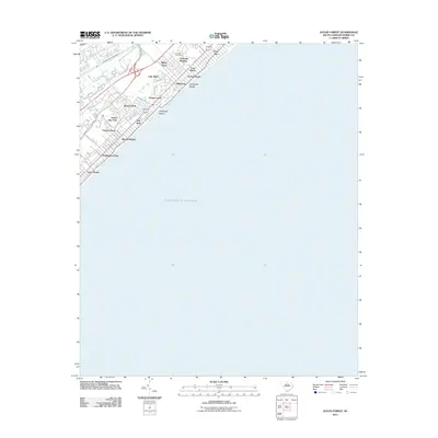
2011 Map of Ocean Forest
USGS Topo · Published 2011About this map
Intracoastal Waterway and the Atlantic Ocean define the narrow coastal corridor of Horry County at the start of the 2010s. This survey details the residential and recreational fabric of the Grand Strand north of the main downtown area, where local drainages like Canepatch Swash and Deephead Swash cut through the sandy terrain toward the sea. The map documents a dense network of neighborhoods including Blynn Acres, Oakland Heights, and Forest Dunes, reflecting the intense development of this tourist-driven region. Of particular interest to local historians is the Live Oak Post Office and the alignment of the Robert M Grissom Pkwy, which serves as a primary north-south artery inland from the coastline. The map provides a precise look at the transition from the winding roads of Lake Shore and Ocean Forest to the structured street grid of Myrtle Heights.
Find a feature on this map
43 named features on this map. Tap any name to fly to it.
Don’t see what you’re looking for? This feature index may not catch every label — zoom into the map to look around manually.
Map Details
Editions of this 2011 Ocean Forest Map
This is the sole edition of this map. No revisions or reprints were ever made.
Other maps of this area

1937 · Myrtle Beach
USGS Topo · 1:48,000

1937 · Nixonville
USGS Topo · 1:48,000

1940 · Myrtle Beach
USGS Topo · 1:62,500

1942 · Nixonville
USGS Topo · 1:62,500

1943 · Wampee
USGS Topo · 1:24,000

1949 · Georgetown
USGS Topo · 1:250,000

1967 · Georgetown
USGS Topo · 1:250,000

1974 · Georgetown
USGS Topo · 1:250,000
1984 · Nixonville
USGS Topo · 1:24,000
1984 · Ocean Forest
USGS Topo · 1:24,000