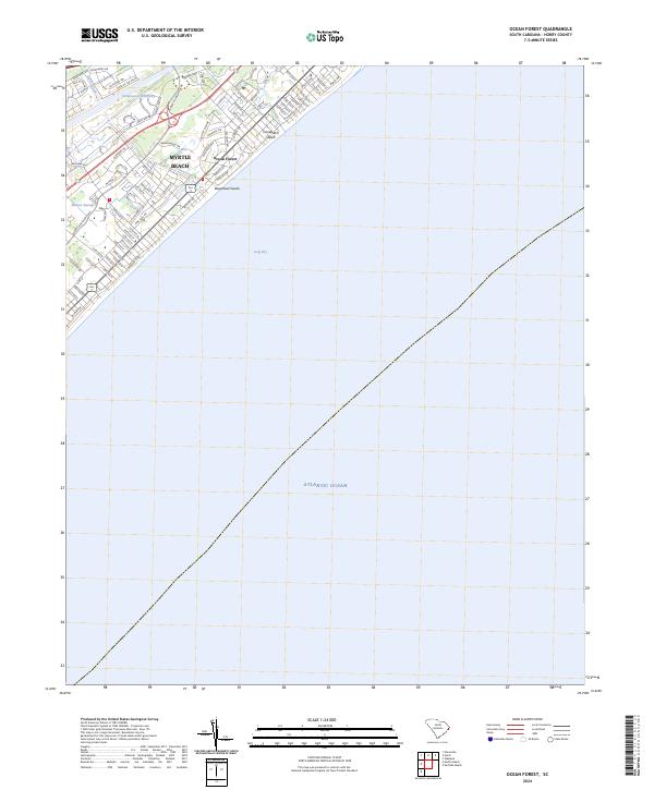
2024 Map of Ocean Forest
USGS Topo · Published 2024About this map
Myrtle Beach and the Ocean Forest neighborhood represent the dense coastal development along the Grand Strand of South Carolina as it appears today. This modern survey illustrates the complex intersection of natural drainage and urban planning, where coastal inlets like Canepatch Swash and Deephead Swash meet the organized street grids of N Ocean Blvd and Porcher Dr. Inland, the Intracoastal Waterway cuts a distinct industrial and recreational path parallel to the shore, bordered by the wooded reaches of Withers Swamp and residential enclaves such as those along Robert M Grissom Pkwy. The map provides a detailed view of the modern infrastructure supporting this resort region, from the residential clusters near Black Creek to the expansive views over Long Bay and the Atlantic Ocean.
Find a feature on this map
74 named features on this map. Tap any name to fly to it.
Don’t see what you’re looking for? This feature index may not catch every label — zoom into the map to look around manually.
Map Details
Editions of this 2024 Ocean Forest Map
This is the sole edition of this map. No revisions or reprints were ever made.
Other maps of this area

1937 · Myrtle Beach
USGS Topo · 1:48,000

1937 · Nixonville
USGS Topo · 1:48,000

1940 · Myrtle Beach
USGS Topo · 1:62,500

1942 · Nixonville
USGS Topo · 1:62,500

1943 · Wampee
USGS Topo · 1:24,000

1949 · Georgetown
USGS Topo · 1:250,000

1967 · Georgetown
USGS Topo · 1:250,000

1974 · Georgetown
USGS Topo · 1:250,000
1984 · Nixonville
USGS Topo · 1:24,000
1984 · Ocean Forest
USGS Topo · 1:24,000