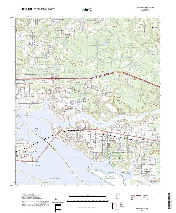
2024 Map of Ocean Springs
USGS Topo · Published 2024About this map
Ocean Springs and Biloxi dominate the coastal interface where the Back Bay of Biloxi meets the Gulf of Mexico. This modern survey illustrates a landscape defined by extensive protected wetlands, specifically the Mississippi Sandhill Crane National Wildlife Refuge and the Gulf Islands National Seashore. The geography is characterized by intricate bayous and points, such as Old Fort Bayou and Marsh Point, which have historically dictated the development patterns of St. Martin and Gulf Hills.
Find a feature on this map
43 named features on this map. Tap any name to fly to it.
Don’t see what you’re looking for? This feature index may not catch every label — zoom into the map to look around manually.
Map Details
Editions of this 2024 Ocean Springs Map
This is the sole edition of this map. No revisions or reprints were ever made.
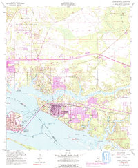
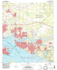
Historical Maps of Ocean Springs Through Time
3 maps found