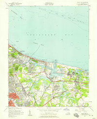
1954 Map of Ocean View
USGS Topo · Published 1958About this map
The U S Naval Reservation Little Creek Naval Amphibious Base dominates the shoreline of this mid-century survey, sitting where the waters of the Chesapeake Bay meet the intricate inlets of Little Creek. The map documents a period of rapid suburban expansion as the City of Norfolk boundary meets Princess Anne Co. Dense residential developments like Cherokee Heights, Roosevelt Gardens, and Norview Heights fill the landscape between the coast and the Norfolk Municipal Airport.
Find a feature on this map
71 named features on this map. Tap any name to fly to it.
Don’t see what you’re looking for? This feature index may not catch every label — zoom into the map to look around manually.
Map Details
Editions of this 1954 Ocean View Map
This is the sole edition of this map. No revisions or reprints were ever made.
Other maps of this area

1907 · Norfolk
USGS Topo · 1:125,000

1907 · Hampton
USGS Topo · 1:62,500

1918 · Cape Henry
USGS Topo · 1:62,500

1919 · Cape Henry
USGS Topo · 1:62,500

1921 · Newport News
USGS Topo · 1:62,500

1943 · Richmond
USGS Topo · 1:250,000

1944 · Hampton
USGS Topo · 1:24,000

1944 · Norfolk South
USGS Topo · 1:25,000

1948 · Norfolk South
USGS Topo · 1:24,000

1948 · Ocean View
USGS Topo · 1:24,000