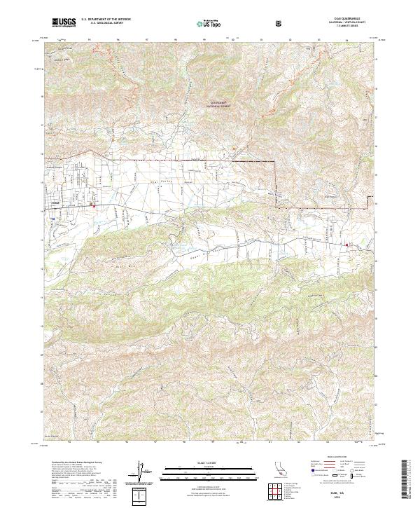
2022 Map of Ojai
USGS Topo · Published 2022About this map
Ojai sits at the foot of the Topatopa Mountains, where the modern landscape transitions from the developed Ojai Valley to the protected expanse of the Los Padres National Forest. This survey illustrates the intricate relationship between the valley floor and the surrounding heights of Nordhoff Ridge and Sulphur Mountain. Water management is central to the area's geography, visible in the Senior Canyon Reservoir and Lion Canyon Reservoir, which serve the agricultural and residential needs of the valley.
Find a feature on this map
58 named features on this map. Tap any name to fly to it.
Don’t see what you’re looking for? This feature index may not catch every label — zoom into the map to look around manually.
Map Details
Editions of this 2022 Ojai Map
This is the sole edition of this map. No revisions or reprints were ever made.
Other maps of this area

1903 · Santa Paula
USGS Topo · 1:62,500

1903 · Mt. Pinos
USGS Topo · 1:125,000

1904 · Ventura
USGS Topo · 1:62,500

1941 · Ventura
USGS Topo · 1:62,500

1942 · Santa Paula
USGS Topo · 1:62,500

1942 · Wheeler Springs
USGS Topo · 1:24,000

1943 · Topatopa Mountains
USGS Topo · 1:24,000

1943 · Lion Canyon
USGS Topo · 1:24,000

1943 · Wheeler Springs
USGS Topo · 1:24,000
1944 · Wheeler Springs
USGS Topo · 1:31,680