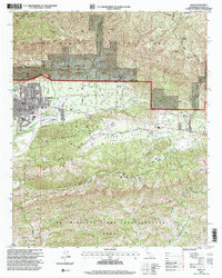
1995 Map of Ojai
USGS Topo · Published 2000About this map
Ojai sits at the foot of the Los Padres National Forest, where the transition from the valley floor to the high ridges of Nordhoff Pk is sharply defined by the Corporate Boundary. This mid-1990s survey illustrates a landscape deeply influenced by historical land tenure, showing the large tracts of the Ex Mission San Buenaventura Grant and the Canada Larga Verde Grant. These Spanish and Mexican era land divisions still influence property lines and road placements, such as Gridley Road and Grand Ave.
Find a feature on this map
39 named features on this map. Tap any name to fly to it.
Don’t see what you’re looking for? This feature index may not catch every label — zoom into the map to look around manually.
Map Details
Editions of this 1995 Ojai Map
This is the sole edition of this map. No revisions or reprints were ever made.
Other maps of this area

1903 · Santa Paula
USGS Topo · 1:62,500

1903 · Mt. Pinos
USGS Topo · 1:125,000

1904 · Ventura
USGS Topo · 1:62,500

1941 · Ventura
USGS Topo · 1:62,500

1942 · Santa Paula
USGS Topo · 1:62,500

1942 · Wheeler Springs
USGS Topo · 1:24,000

1943 · Topatopa Mountains
USGS Topo · 1:24,000

1943 · Lion Canyon
USGS Topo · 1:24,000

1943 · Wheeler Springs
USGS Topo · 1:24,000
1944 · Wheeler Springs
USGS Topo · 1:31,680