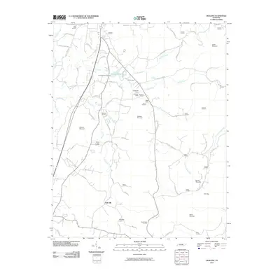
2010 Map of Okalona
USGS Topo · Published 2010About this map
Oak Hill serves as a central anchor in this section of Overton County, where the landscape is defined by the winding course of the Roaring River and its numerous tributaries. The terrain transitions from the waters of Livingston City Lake in the north to the distinctive elevations of Hellhole Mountain and Brushy Mountain further south. This 2010 survey illustrates a rural settlement pattern deeply rooted in family history, evidenced by a high density of small burial grounds scattered throughout the coves and ridges.
Find a feature on this map
79 named features on this map. Tap any name to fly to it.
Don’t see what you’re looking for? This feature index may not catch every label — zoom into the map to look around manually.
Map Details
Editions of this 2010 Okalona Map
This is the sole edition of this map. No revisions or reprints were ever made.
Other maps of this area

1897 · Standingstone
USGS Topo · 1:125,000

1898 · Standingstone
USGS Topo · 1:125,000

1943 · Cookeville
USGS Topo · 1:100,000

1944 · Cookeville
USGS Topo · 1:100,000

1944 · Livingston
USGS Topo · 1:24,000

1946 · Obey City
USGS Topo · 1:24,000
1950 · Obey City
USGS Topo · 1:24,000

1951 · Windle
USGS Topo · 1:24,000

1953 · Cookeville East
USGS Topo · 1:24,000

1954 · Crawford
USGS Topo · 1:24,000