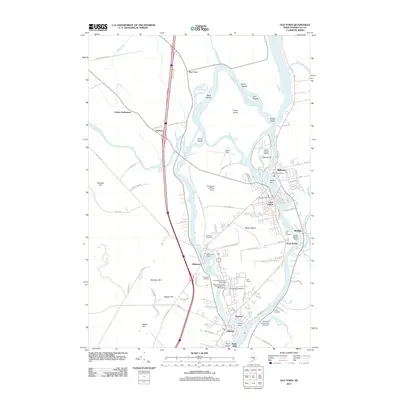
2011 Map of Old Town
USGS Topo · Published 2011About this map
The Penobscot River and its western channel, the Stillwater River, define a landscape shaped by river power and higher education in this early 21st-century survey. Old Town and Orono anchor the southern portion of the map, centered around the sprawling campus of the University of Maine. The map captures a complex river network where industrial history meets modern infrastructure, shown through the series of obstructions including the Milford Dam, Stillwater Dam, and Orono Dam. On Marsh Island, several historic burial grounds like Woodlawn Cemetery and Riverside Cemetery are visible near the university and the residential core. Further north, the river splits around numerous landmasses such as Indian Island and Orson Island, while the Old Town Post Office marks the civic center of the community east of Dewitt Field.
Find a feature on this map
92 named features on this map. Tap any name to fly to it.
Don’t see what you’re looking for? This feature index may not catch every label — zoom into the map to look around manually.
Map Details
Editions of this 2011 Old Town Map
This is the sole edition of this map. No revisions or reprints were ever made.
Other maps of this area

1902 · Orono
USGS Topo · 1:62,500

1902 · Bangor
USGS Topo · 1:62,500

1917 · Passadumkeag
USGS Topo · 1:62,500

1933 · Boyd Lake
USGS Topo · 1:62,500

1942 · Bangor
USGS Topo · 1:62,500

1944 · Orono
USGS Topo · 1:62,500

1946 · Bangor
USGS Topo · 1:62,500

1946 · Orono
USGS Topo · 1:62,500

1948 · Bangor
USGS Topo · 1:250,000

1951 · Boyd Lake
USGS Topo · 1:50,000