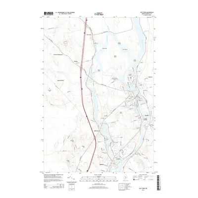
2014 Map of Old Town
USGS Topo · Published 2014About this map
The Penobscot River and its intricate network of branches and islands define the landscape of this Penobscot County region. Indian Island, located just north of Milford, stands at the heart of the river's path, near several smaller landforms like Orson Island and the Boom Islands. The topography illustrates how the waterway separates the primary settlement of Old Town from the riverside community of Bradley and the industrial area of Great Works. To the south, the expansive campus of the Univ of Maine occupies a significant portion of the land between the Stillwater River and the main Penobscot channel.
Find a feature on this map
117 named features on this map. Tap any name to fly to it.
Don’t see what you’re looking for? This feature index may not catch every label — zoom into the map to look around manually.
Map Details
Editions of this 2014 Old Town Map
This is the sole edition of this map. No revisions or reprints were ever made.
Other maps of this area

1902 · Orono
USGS Topo · 1:62,500

1902 · Bangor
USGS Topo · 1:62,500

1917 · Passadumkeag
USGS Topo · 1:62,500

1933 · Boyd Lake
USGS Topo · 1:62,500

1942 · Bangor
USGS Topo · 1:62,500

1944 · Orono
USGS Topo · 1:62,500

1946 · Bangor
USGS Topo · 1:62,500

1946 · Orono
USGS Topo · 1:62,500

1948 · Bangor
USGS Topo · 1:250,000

1951 · Boyd Lake
USGS Topo · 1:50,000