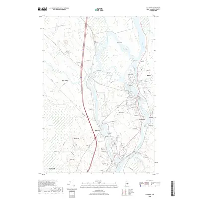
2018 Map of Old Town
USGS Topo · Published 2018About this map
Penobscot River and Stillwater River define the intricate geography of this region, creating a series of substantial river islands including Orson Island, Marsh Island, and Indian Island. The landscape is a complex mix of academic, municipal, and indigenous spaces, anchored by the sprawling campus of the Univ of Maine in the south and the Dewitt Field, Old Town Municipal Airport to the north. Settlement patterns follow the waterways, with the communities of Stillwater, Great Works, and Milford lining the banks, reflecting a history deeply tied to the river's flow and the power it provided.
Find a feature on this map
106 named features on this map. Tap any name to fly to it.
Don’t see what you’re looking for? This feature index may not catch every label — zoom into the map to look around manually.
Map Details
Editions of this 2018 Old Town Map
This is the sole edition of this map. No revisions or reprints were ever made.
Other maps of this area

1902 · Orono
USGS Topo · 1:62,500

1902 · Bangor
USGS Topo · 1:62,500

1917 · Passadumkeag
USGS Topo · 1:62,500

1933 · Boyd Lake
USGS Topo · 1:62,500

1942 · Bangor
USGS Topo · 1:62,500

1944 · Orono
USGS Topo · 1:62,500

1946 · Bangor
USGS Topo · 1:62,500

1946 · Orono
USGS Topo · 1:62,500

1948 · Bangor
USGS Topo · 1:250,000

1951 · Boyd Lake
USGS Topo · 1:50,000