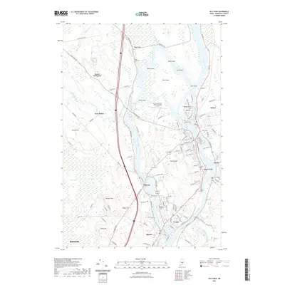
2021 Map of Old Town
USGS Topo · Published 2021About this map
The Penobscot River and Stillwater River define this riverine landscape, where the waters divide around numerous landmasses including Orson Island, Marsh Island, and Orono Island. This 2021 update reveals the complex hydrology of the region, from the extensive Caribou Bog and Alton Bog to the smaller channels of Pushaw Stream and Sunkhaze Stream. The map documents the educational and industrial centers of the area, featuring the sprawling grounds of the University of Maine in Orono and the settled riverfronts of Old Town, Milford, and Bradley. A rich network of local cemeteries, such as Maple Grove Cem, Riverside Cem, and the Tribal Cem on Indian Island, provides valuable points of reference for genealogical research and local history within these historic Maine communities.
Find a feature on this map
120 named features on this map. Tap any name to fly to it.
Don’t see what you’re looking for? This feature index may not catch every label — zoom into the map to look around manually.
Map Details
Editions of this 2021 Old Town Map
This is the sole edition of this map. No revisions or reprints were ever made.
Other maps of this area

1902 · Orono
USGS Topo · 1:62,500

1902 · Bangor
USGS Topo · 1:62,500

1917 · Passadumkeag
USGS Topo · 1:62,500

1933 · Boyd Lake
USGS Topo · 1:62,500

1942 · Bangor
USGS Topo · 1:62,500

1944 · Orono
USGS Topo · 1:62,500

1946 · Bangor
USGS Topo · 1:62,500

1946 · Orono
USGS Topo · 1:62,500

1948 · Bangor
USGS Topo · 1:250,000

1951 · Boyd Lake
USGS Topo · 1:50,000