2024 Map of Old Town
USGS Topo · Published 2024About this map
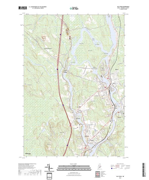
The Penobscot River and its western channel, the Stillwater River, define a landscape of sprawling islands and riverbank settlements. Old Town and Milford occupy the banks near the southern tip of the Sunkhaze Meadows National Wildlife Refuge, while the University of Maine campus is situated between the river forks in Orono. The presence of several large islands, such as Marsh Island, Orson Island, and Indian Island, suggests a historical reliance on water-based transport and geography that shaped the industrial and residential development of Webster and Bradley. Farther north, smaller hamlets like Pea Cove and the French Settlement sit along the winding Pushaw Stream, marking the transition into the more marshy terrain of the Alton Bog.
Find a feature on this map
116 named features on this map. Tap any name to fly to it.
Don’t see what you’re looking for? This feature index may not catch every label — zoom into the map to look around manually.
Map Details
Editions of this 2024 Old Town Map
This is the sole edition of this map. No revisions or reprints were ever made.
Historical Maps of Indian Island / Alənαpayí-Mənəhan Through Time
3 maps found