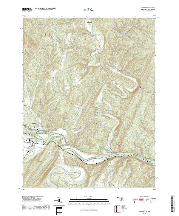
2023 Map of Oldtown
USGS Topo · Published 2023About this map
The North Branch Potomac River and its larger sibling, the Potomac River, dominate this landscape at the border of Maryland and West Virginia. This region is defined by the narrow corridors of the Chesapeake and Ohio Canal and the CSX Transportation railroad, which follow the water gaps through a series of north-south ridges like Warrior Mtn and Stratford Ridge. The settlement of Oldtown serves as a local hub, featuring several legacy sites including the Oldtown Catholic Cem and the Veterans of Foreign Wars Burial Park.
Find a feature on this map
110 named features on this map. Tap any name to fly to it.
Don’t see what you’re looking for? This feature index may not catch every label — zoom into the map to look around manually.
Map Details
Editions of this 2023 Oldtown Map
This is the sole edition of this map. No revisions or reprints were ever made.
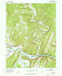
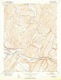
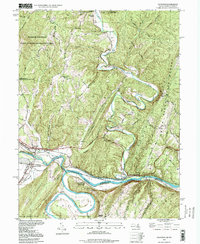
Historical Maps of Oldtown Through Time
4 maps found